A field investigation · Marathon County, Wisconsin
Four steel towers stood in a farm field for sixty years. Nobody I asked could tell me what they were.
45.02606° N 89.58888° WTown of Wausau · Sec 5, T29N, R8E
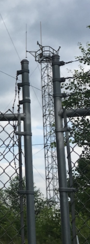
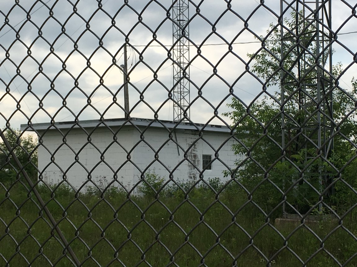
North of Wausau, off a two-lane blacktop that the county calls Radar Road, four guyed lattice towers rise out of an old dairy field behind a chain-link fence topped with barbed wire. A small white cinder-block building sits at the center. There is no sign, no gate code, no company name — just the towers, the fence, and the tall grass reclaiming the whole thing.
I've wondered about these towers since I was a teenager. In the late 1970s I'd head up this road to the golf course my dad ran, and they were always there, off to the side — four steel towers behind a fence, saying nothing.
Back then I all but lived at the Flight Service Station at the Wausau Downtown Airport, a couple of blocks from my house. On hot summer afternoons I'd sit in the air conditioning and pester the FAA men and women who worked there — weather briefings, flight plans, the radios crackling with pilots overhead — until a weather-obsessed kid became a friend. So I asked the people whose whole job was the sky over Wausau: what are those towers? They didn't know. It wasn't the VOR — that beacon sat south of town, between Central Wisconsin Airport and the downtown field. Beyond that they had no idea. Neither did anyone else I asked, for the next forty years.
The name of the road practically dares you to say "radar." But there's no dish, no dome, no rotating antenna — nothing that looks like radar at all. So this year I finally did what I should have done as that kid with all his questions: I stopped, took photographs through the fence, and started pulling on the thread.
What the towers told me
The towers were the first evidence. Each is about 80 feet tall, and they sit on the four corners of a near-perfect square roughly 80 feet on a side — I measured it later from the survey coordinates. Every tower is topped with an odd cage-and-platform structure and a set of thin vertical whip antennas held out on four arms. On the surviving southwest tower, two of the original whips are still standing, pointing straight up.
A square of four antennas feeding a central building is a specific, recognizable thing. So is the top-loading. This was a radio installation — transmitting or receiving, not scanning the sky. Whatever "Radar Road" meant to the neighbors, the steel said communications.
The confident wrong answer
Here is the part I have to tell honestly, because it is the most useful part. The geometry, the era, and the neighbors all pointed one way. Twenty-five miles northeast sat Antigo Air Force Station, a Cold-War radar base that watched the northern sky for Soviet bombers. Digging through the county's online land records, I found the government buying up small parcels all over the area around 1960 — a "GATR" air-defense site here, an air-traffic parcel there, all handled by the Army Corps of Engineers.
A four-tower square, top-loaded antennas, a secured federal compound, the right decade, an air-defense base next door. I built a tidy, confident case: this was a military high-frequency direction finder — a listening station triangulating distant transmitters. It fit every piece of evidence I had. It was also completely wrong.
A U.S. Air Force Cold-War direction-finding station, part of the Antigo air-defense network, triangulating Soviet signals.
Every clue I had was real. The story I built from them was not. A coherent chain of inference is not evidence — and the neighboring military sites, which made the Air Force answer feel inevitable, turned out to be coincidences. The only thing that could settle it was a piece of paper with the tenant's name on it.
Following the paper
The land itself had never been sold to the government — so there was no deed to name the agency. What there was, buried in the grantor index under the name of the farmer who owned the field, was a lease. To find it I had to walk the whole chain of title backward, from today's owners all the way to the 1950s.
Assessed value of the towers and building today: $0.00. The county files them as worth nothing — a fair epitaph for a piece of infrastructure nobody remembers the purpose of.
The answer, in the government's own words
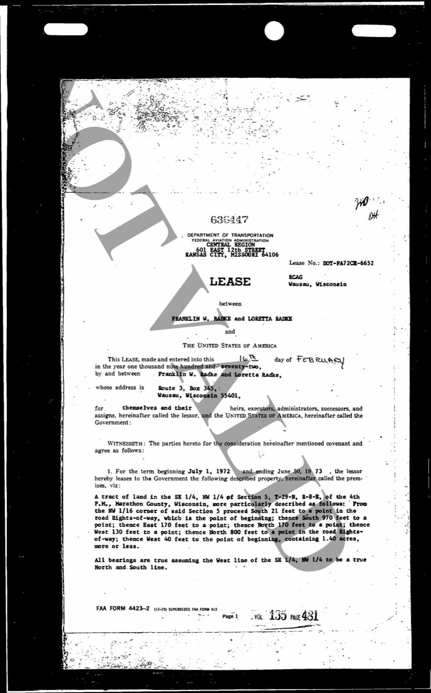
The 1972 lease is on Department of Transportation letterhead — Federal Aviation Administration, Central Region. Not the Air Force. Not air defense. Not intelligence. Typed across the top is the facility's name:
RCAG — Remote Communications, Air / Ground. Wausau, Wisconsin.
An RCAG is one of the least glamorous and most necessary things in the sky: an unmanned radio relay. An air-traffic-control center can't reach its whole airspace by radio from one antenna, so it runs a network of remote sites, each covering a slice of the map. The towers on Radar Road were how a controller — probably at Minneapolis Center — kept talking to the pilots of airliners and Cessnas crossing central Wisconsin, right along the old Minneapolis–Wausau–Green Bay airway.
The rent, from the farmer to the United States government, was one hundred dollars a year.
There is a small, perfect irony in it. The FAA men and women I pestered as a teenager — who knew every frequency in the Wausau sky and still couldn't tell me what those towers were — had been stumped, all along, by the quiet handiwork of their own agency.
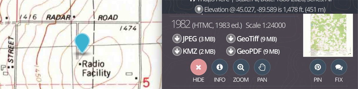
And the road? A misnomer, as the maps quietly insisted all along. The 1982 U.S. Geological Survey quad doesn't say "radar." It labels the spot Radio Facility — parked right on Radar Road, the county's own small joke about a thing it had already forgotten.
Coda
There is one more thing the paper gave me, and it is the reason this stopped being a puzzle and became a story I wanted to keep.
The farmer who leased that corner of his pasture to the FAA was Frank Radke — a Town of Wausau dairyman who milked cows for more than forty years and served as town chairman for twenty-four. For a hundred dollars a year, he let the government put up four towers so airplanes could talk to the ground.
Frank was a friend of my father's — they knew each other through golf. From 1974 to 1986 my dad was the golf management professional at Trapp River Golf Course, north of Wausau, and Frank was one of the men who played there. Both of them are gone now. I spent one long evening chasing anonymous names through the county's scanned deed books online, one record at a time — Nsight, Carl Bros, a foreclosed farm, a post office — and the name at the bottom of it all belonged to a man my father had known on the fairways, a few miles from this field.
The Cold War is over. The FAA moved on. The cellular company walked away. But the towers still stand in Frank Radke's former field, doing nothing, remembering nothing — until someone stops at the fence and asks.
The internet is forever is a lie. So, it turns out, is federal infrastructure. What survives is the asking.